For most of the 20th century, the Myeik (formerly Mergui) Archipelago in Myanmar’s far south was rarely visited by foreigners. The few transport services available were unreliable and modern amenities like hotels and restaurants were almost non-existent. There were occasional naval patrols but security was poor and the safety of travelers could not be guaranteed. After General Ne Win’s coup d’etat in 1962, official restrictions on travel to the region were imposed, prompting the name “the forbidden islands.”
Over the past 20 years, the situation has changed, but the future of this remote and little-known part of Myanmar remains uncertain.
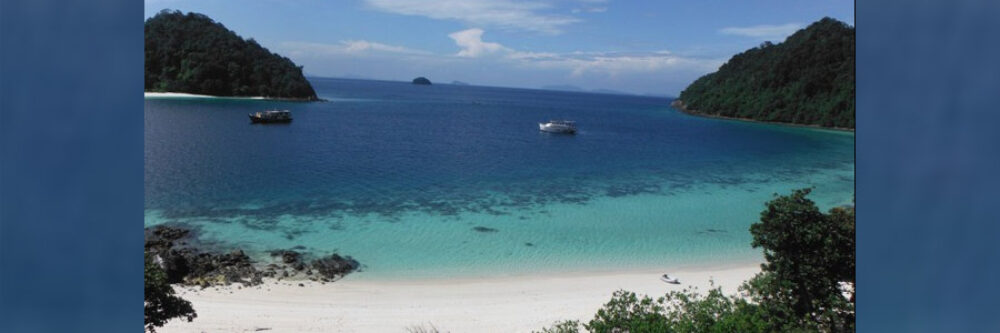
The Myeik Archipelago consists of 804 islands stretching 400km down the coast of Tanintharyi (old Tenasserim) Division, from Dawei (formerly Tavoy) in the north to Kawthaung (Victoria Point) in the south. This 26,000 sq. km region is very lightly populated. Indeed, most islands are uninhabited, although some host small communities of Moken sea nomads, also known as Salone or Selung. Apart from a few military installations and huts used by seasonal fishermen, there are no settlements to speak of.
During the 17th and 18th centuries, Mergui on the mainland was a busy seaport and trading center where goods were offloaded for the journey overland to Thailand, then called Siam. In 1859, after conquering lower Myanmar, the British government investigated the feasibility of constructing a 113 km-long ship canal across the Kra isthmus to facilitate the flow of trade goods from India to Bangkok and Singapore. Ships often sheltered in the archipelago, waiting for favorable weather to cross the Indian Ocean.
Please click here to read the full “Myanmar, Myeik and mythmaking” article in the Nikkei Review by Griffith Asia Institute Adjunct Associate Professor, Dr Andrew Selth.