REBECCA STRATING AND JOANNE WALLIS |
Climate change has the potential to undermine the maritime resource entitlements of Pacific island states. Resource-rich maritime areas are a vital source of revenue for these states and central to their identity as ‘large ocean states’ in the ‘Blue Pacific’.
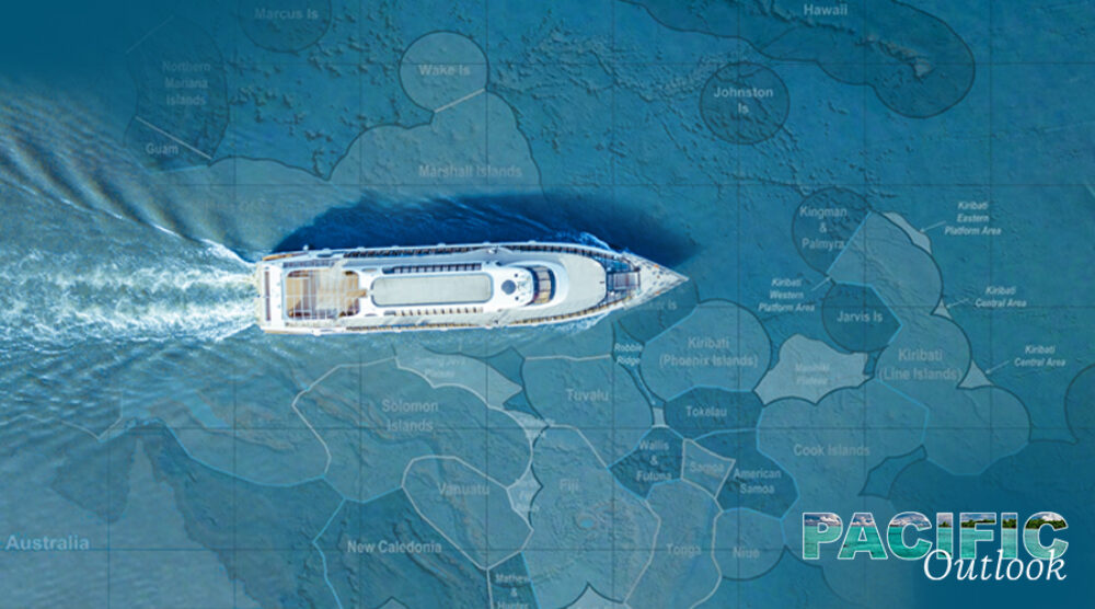
Maritime rights to the resources in the seabed and water column, such as oil, gas, minerals and fish, derive from the zoning regime established in the United Nations Convention on the Law of the Sea (UNCLOS). This convention is estimated to have given Pacific island states over 30,569,000 km2 of Exclusive Economic Zone (EEZ) area, in contrast to their combined landmass of 552,789 km2 (84 per cent of which is Papua New Guinea).
Many Pacific island states depend on fisheries that provide revenue from licences and access agreements, an important source of food and income, and a source of employment. The region’s tuna fisheries, for instance, were valued at around US$6 billion in 2018, and for smaller states, it is one of the few non-aid sources of foreign income. Seabed mining presents another potential future source of revenue as technology for locating and extracting these minerals improves, particularly as many of the minerals critical to supporting renewable energy technology are found in the seabed.
However, rising sea levels are likely to alter the coastlines of Pacific island states. Several of the ‘normal baselines’ of Pacific island states, from which maritime jurisdiction is measured, are vulnerable to inundation as sea levels rise. Baselines are generally thought to be ‘ambulatory’ under international law, which means that as coastlines changes so to do baselines. For example, Marshall Islands, Tokelau, Tuvalu and Kiribati are wholly, or almost entirely, made up of low-elevation atolls and reef features which means that if the territory disappears, so too does their maritime area.
This raises the question of whether these states should be able to fix these baselines (and consequently their maritime boundaries) before they erode or are inundated as a result of climate change.
Pacific island states’ responses
Pacific island states have responded to the challenges of climate change to their maritime boundaries with a high level of regional solidarity and international activism under the auspices of the Pacific Islands Forum (PIF). Since 1974 Pacific island states have been working together to redraw and publicly declare their maritime baselines and boundaries to pre-empt arguments that climate change-induced sea level rise will change their baselines and maritime jurisdictions. Pacific states have also been encouraged to take unilateral action to develop customary law by fixing maritime boundaries.
These regional efforts to secure maritime boundaries have accelerated over the last 20 years. In 2010 the PIF developed a Framework for a Pacific Oceanscape, which set out the need for a ‘united regional effort that establishes baselines and maritime zones so that areas could not be challenged and reduced due to climate change and sea level rise’. These commitments have been echoed in subsequent regional declarations, such as the 2014 Palau Declaration and Delap Commitment on Securing Our Common Wealth of Oceans.
The 2019 PIF leaders’ meeting identified the need to develop international law to ensure PIF Member’s maritime zones are not eroded due to the impacts of climate change. In 2018, the International Law Association Committee on Sea Level Rise and International Law endorsed a recommendation that established baselines, maritime zones or both be fixed and that there be no requirement to recalculate them based on sea level rise.
Implications for Australia
Australia shares—although to a less significant degree—the challenge that rising sea levels pose to maritime boundaries. Australia has the world’s third largest EEZ. Australia’s islands and atolls in the Coral Sea and the Cocos Keeling Atoll islands face similar vulnerabilities to climate change, which will have consequences for Australia’s maritime boundaries.
Australia has contributed to regional efforts to consolidate maritime boundaries through the Pacific Islands Regional Maritime Boundaries Project, a partnership between the Pacific Community (SPC) and the Australian government that has provided assistance to Pacific states to clarify the extent of their maritime jurisdictions. The Project has assisted Pacific states to use geographic information systems to declare their maritime zones using geographic coordinates, rather than distance from the baseline, and a forum for Pacific states to negotiate the delimitation of the estimated 49 maritime boundaries between them (13 bilateral boundaries remain unresolved).
Yet, Australia has not taken serious policy action to address climate change. It has been accused of being disingenuous about its claims to be meeting its Paris Agreement targets, and said to have stymied stronger commitments to address climate change within the PIF. Australia’s foot-dragging on climate change—which PIF leaders (including Australia) have identified as ‘single greatest threat’ to the region—risks encouraging Pacific island states to seek closer relations with powers that have interests potentially inimical to Australia, particularly China.
Finding legal, political and environmental solutions to the issue of sea-level rise and baselines is crucial in the Pacific. The Pacific is already highly susceptible to Illegal, Unregulated and Unreported (IUU) Fishing: it is estimated that 20 per cent of wild-caught fish is illegally caught.
The challenges that climate change poses to the capacity of smaller Pacific island states to access their maritime resources under international law will also exacerbate existing human security challenges, through, for example, the developmental impacts of lost revenues and increased food insecurity.

Dr Rebecca Strating is the Executive Director of La Trobe Asia and a Senior Lecturer of Politics and International Relations in the Department of Politics, Media and Philosophy at La Trobe University, Melbourne. . Her latest book, The Post-Colonial Security Dilemma, was published by the Institute of Southeast Asian Studies in 2019. In 2018, her article on the Timor Sea maritime dispute was awarded the prestigious Boyer Prize by the Australian Institute of International Affairs for best article published in the Australian Journal of International Affairs in 2017.

Professor Joanne Wallis is Professor of International Security in the Department of Politics and International Relations at the University of Adelaide. She is the author or editor of seven books, including Constitution making during State building (CUP 2014) and Pacific Power? Australia’s Strategy in the Pacific Islands (MUP 2017). Joanne is the chief investigator on two Australian Research Council Discovery Projects, analysing Australian interventions in the Pacific Islands and the operation of the Australia-New Zealand alliance. She is also the chief investigator on a Defence Strategic Policy Grant analysing the potential of networked security architecture in the Pacific Islands. Joanne co-edits Peacebuilding and is on the editorial advisory committee of Asia Policy, the international advisory board of The Round Table and the editorial boards of the Australian Journal of International Affairs and Global Studies Quarterly.
Please click here to read the Regional Outlook Climate Action series working paper “Climate change and maritime boundaries: Pacific responses and implications for Australia” written by Rebecca Strating and Joanne Wallis.